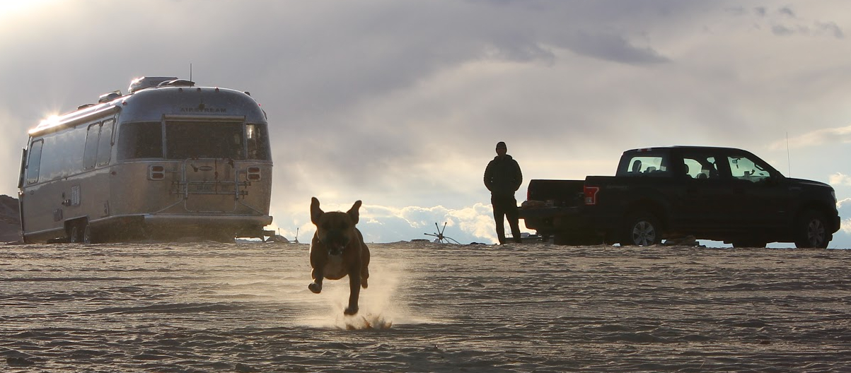
We were in Lost Dutchman in February 2021, as part of our Winter Warmth Trip.

Lucky us: we left one absurdly beautiful Arizona state park and headed to another. From Catalina State Park just north of Tucson it’s a 1.5-hour drive up to Lost Dutchman State Park, east of Apache Junction, a suburb of Phoenix. The park is full of wacky desert flora and fauna (we found the birds particularly comical) under the abrupt, massive volcanic upthrusts of the Superstition Mountains, a perfect canvas for sunset.
Campground


This was one of the more scenic campgrounds where we have parked the Airstream! Lost Dutchman has 68 water/power sites and a bunch more dry sites arranged in a swirly loop-de-loo and I believe all the sites have a view of the Superstition cliffs.


Our view from Site 55 was perfect and we spent a lot of time relaxing at our picnic table looking at those mountains.
Hiking

A few short hiking trails and a mountain bike loop wind around the park, but the real excitement comes once you cross beyond the park boundary into the Superstition Mountains and Tonto National Forest. Below are the trails we hiked, in descending order of difficulty:
Siphon Draw Trail to the Flatiron

The Flatiron is one of the giant rock formations hulking over the park, and climbing to the top of the Flatiron is supposedly one of the most famous hikes in Arizona. Note that I said “climbing” rather than “hiking.” Holy cow. The trail starts off innocently enough, with a gentle incline into the Siphon Draw canyon. You’ll reach a cool slickrock basin where the Siphon Draw Trail ends (and many people turn around) and the unmaintained, unofficial trail to the Flatiron summit begins and heads straight up the side of the cliff, gaining 2000′ over one mile.

\We found it hard to follow in places (tip: hug the left wall going up) and slid through a few sketchy rock scrambles but made it to the top and enjoyed the sweeping views with a bunch of other people, some very loud, before heading down. As always, go early to beat the crowds (and heat–there’s no cover). There were a million people heading up as we went down and we passed quite a few backups at narrow spots. I guess you’re less likely to lose the trail if you’re following a line of people though.

The total hike is about 6 miles; factor in the extra time on the mile of straight up and mile of straight down when planning water supply. It was a fun adventure, and the challenge made it extra rewarding, but: the main views are of the Apache Junction valley, which is cool but it’s civilization, and we prefer views that aren’t of cities. You can see into the Superstition Mountains from the far side of the Flatiron, but it’s essentially the same views as you get from the next hike we’ll talk about for a lot less work and a lot more solitude.

This kind of sounds like a negative review. It was fun and interesting and unique! But hard and crowded! Is the payoff worth the effort? You should do it and tell us what you think. Don’t take your dog, though, unless she’s in a backpack–dogs are allowed, but the rock scrambles are not dog-friendly.
Treasure Loop – Jacob’s Crosscut – Prospector’s View to Praying Hands


We knew we wanted to hike to Praying Hands, a distinctive rock formation at the base of the cliffs, and assembled a 6-mile loop to get there. It’s easy to combine other trails (here’s a shorter loop); you can’t go wrong picking a route and the views from Praying Hands into the mountains beyond are gorgeous. This was our favorite hike in Lost Dutchman.
Treasure Loop

This was a pleasant, easy 2.5-mile loop up to the base of the cliffs. There’s a bit of elevation gain, but nothing too strenuous.
Quail Loop

Quail Loop was the easiest hike we did in the park: about two miles long, and mostly flat. It’s a pretty hike with lots of birds to entertain you, but the occasional mountain bike zooming up behind you may disrupt your reverie.
Civilization
Apache Junction is a mid-sized Phoenix suburb just a few miles away from Lost Dutchman, with just about any store you could need for supplies. We restocked at Fry’s, a huuuuuge grocery store, and then had a really delicious lunch at Saigon Noms, a Vietnamese street food restaurant.
If you need a quick bite close to home, Hitching Post Saloon serves pizza and chicken and occasional live music. We didn’t try it but it was recommended. And if the kids get bored with nature, there’s a weird tourist trap just down street from Lost Dutchman that might be entertaining, Goldfield Ghost Town.
To do

We got views deeper into the rugged and beautiful Superstition Mountains from the top of Flatiron and from Praying Hands, and we’re keen to explore farther into the range, outside of Lost Dutchman. Someday we’ll check out some of the other trails in the area.
Anything else we should do around Phoenix? Until now we’ve avoided it since it’s a sprawling megapolis, but maybe there are more gems like Lost Dutchman scattered about!


Leave a Reply