We visited Death Valley in December 2023, as part of our Tucson for Christmas trip.

Death Valley is HUGE: it’s the largest US national park outside of Alaska, larger than Rhode Island and Delaware combined. It’s also the hottest, driest, and lowest national park, and the hottest place Earth, once hitting 134°F! (Beware of the heat if visiting outside the winter months!) The park is 93% wilderness, and has over 1000 miles of paved and dirt roads. So how best to approach spending three days in such a massive place?

Since this was our first visit, we decided to focus on the central Furnace Creek area, with a visitor center and camp store, lots of hiking and sights to see, multiple campground options, a gas station, and a hotel with a restaurant. From Boulder City, Furnace Creek was a pleasant 2.5-hour drive northwest.

Our first stop upon arrival was at the Furnace Creek visitor center for some camping and hiking advice, and as usual, the rangers were super helpful.
History of Death Valley

Natural history

With all the different geological features of Death Valley–soaring mountains, deep basins, slot canyons, sand dunes, salt flats–there has to be an exciting geological history there. Scientists believe the area was covered by a warm, shallow sea in the Paleozoic Era, 542 – 251 million years ago, which laid down layers of sandstone (from sediment) and limestone (from sea creatures). The mountains were then pushed up by plate tectonics in the Mesozoic, 251 – 65.5 million years ago. In the Tertiary, 65.5 – 2 million years ago, Death Valley experienced volcanic activity, depositing layers of ash and cinder along with the igneous rocks from volcanic flows. Finally, around three million years ago, plate activity shifted, pulling the valleys and the mountain ranges apart. Erosion continues to break down the mountains and moves sediment down toward the valley floor.
Human history

Humans have inhabited Death Valley since around 7000 BC; initially, the climate was milder and wetter, and the native hunter-gatherers had access to more large game animals. Most recently, the Timbisha Shoshone tribe has called Death Valley home since 1000 AD, with around 300 tribe members still living in the Death Valley Indian Community at Furnace Creek.
White settlers started arriving in the area during the California gold rush in the mid-1800s, and borax, not gold or silver, turned out to be the big moneymaker in Death Valley. It looked like crystallized cotton balls in the dry lakebeds, created over the millennia as boron from volcanic ash interacted with salts from repeatedly evaporating lakes. Harmony Borax Works operated in Death Valley in the 1880s, becoming famous for using teams of twenty mules to transport the borax to the railroad; Harmony’s ruins are preserved in the national park. Borax has all sorts of commercial uses, including as a cleaning additive, in welding, as an insecticide, as a fire retardant, in ink-making and glass-making and ceramic glazing, to coat playing cards, in swimming pools… and a food additive (but not in the US).
The borax activity slowed down in the late 1920s, and in 1933 President Hoover protected the area with national monument designation; however, limited mining was still allowed until 2005, despite Death Valley obtaining national park status in 1994.
Campground

Within the park, several campgrounds can accommodate our 28′ trailer: Texas Springs, Furnace Creek, and Sunset (in the Furnace Creek area), Mesquite Springs (an hour north), and Stovepipe Wells (40 mins northwest). Furnace Creek is the only one that takes reservations (you can book six months out) and has any hookups (18 full-hookup sites). According to my research, in the Furnace Creek area, Texas Springs and Furnace Creek are the most popular, and Sunset is the biggest and never fills up.

The ranger at the visitor center recommended we try Texas Spring campground for better views, picnic tables, and fire pits. It was a great recommendation, as Sunset just looked like a giant parking lot when we drove by on the way up the hill to Texas Spring–but you can use a generator there and not at Texas Spring, so there’s that.
While we were setting up our campsite, Camp Host Bob came by with a friendly greeting and all sorts of great hiking advice. He confirmed a couple of our planned hikes, and gave us a gem that hadn’t been on our radar. He also said the hikes with the best views are closed from Hurricane Hilary last August. That just means we’ll have to go back!

The top section of the campground, where we were parked, has little trails leading up to high points in the surrounding hills, which would be fantastic perches for sunrise or sunset–we didn’t go up because we didn’t want to ditch sweet Bugsy after hiking without her for much of the day, but it looked like a fun option.
Furnace Creek

Furnace Creek is an oasis in the desert, literally and figuratively–trees! Internet! I’ve already talked about the super visitor center and rangers there. The camp store near the VC has good supplies and basic food, and the Ranch at Death Valley resort–begun as an inn to house visiting borax executives–has a hotel, two restaurants, and a variety of non-hiking activities.

While we scoped it all out, we noticed a bar at the restaurant with TVs showing sports… and our UVA basketball team had a game the following night… it felt weird to spend time in a national park watching TV at a bar, but that’s what we ended up doing! It was a terrible game, and the food was crazy overpriced, but it was a fun evening.
J had a work meeting one morning, so he paid for internet at the hotel and sat on the front porch and had a pretty good working experience. Our campground neighbor from Alaska who works from the road has Starlink and said it’s super, so we’re considering upgrading our internet situation to that in the future. Anybody here have experience with Starlink?
Hiking trails

We came to Death Valley with a wish list of eight hikes and three overlooks, and whittled it down to a reasonable schedule for three days of exploration with the help of the rangers, Camp Host Bob, and practical thinking about drive times. I’ll put the entire list at the bottom of the post; this section will just cover the hikes we actually did.

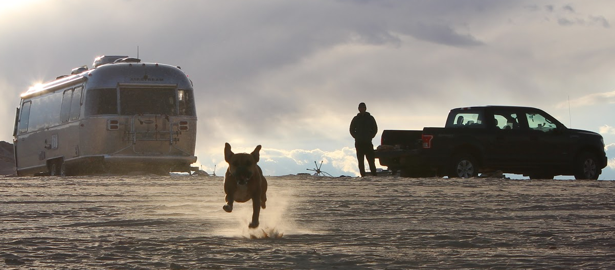
Death Valley is like the majority of US national parks in that dogs are not allowed on hiking trails. You can take your dog anywhere you can take your car–dirt roads are often good bets in national parks.
Golden Canyon

Golden Canyon was our first hike in Death Valley, and we lucked out with no crowds as this is a very popular area of the park. We combined trails for a four-and-a-half-mile loop through Golden Canyon and Gower Gulch, with a side jaunt to Red Cathedral. Warning: Golden Canyon to Red Cathedral is the most popular trail in the national park, so that section will be crowded! For that reason, Red Cathedral was our least favorite part of the hike; our favorite part was the descent into the canyon from Manly Beacon (Manly was the gold prospector who gave Death Valley its name in 1849)–the viewsssssss. Holy moly. Golden Canyon is just a few miles south of Furnace Creek.
Sidewinder Canyon

Sidewinder and Willow trailheads are adjacent to each other, so we combined the two for a longer hike. We did Sidewinder first, a five-mile out-and-back with three slot canyons branching off the main canyon. We thought side canyons #2 and #3 were super cool, and #1 and the main canyon less exciting. Be prepared to scramble through tight squeezes and over large boulders–it’s a fun adventure.
Willow Canyon

To hike Willow Canyon we just followed the trail as marked on the Sidewinder trail map here. Camp Host Bob gave us a paper map of the canyon too–Willow isn’t in the main park literature, so ask a ranger. Willow is very different from Sidewinder: Sidewinder’s walls are made of a knobby composite rock that’s sort of like gravel in cement, while Willow is full of a darker, smoother metamorphic rock. The big payoff of this hike is a waterfall! In the desert! This hike has a tricky scramble toward the end, about 10 feet up a smooth rock, which was even hairier going down. Be careful.

A reminder for hiking slot canyons: check the weather forecast and don’t go if any rain is predicted! A flash flood in a slot canyon is bad news for hikers.
We totaled eleven miles for the day; if you’re not interested in that many miles, our recommendation for most bang for your buck is to just do side canyon #2 in Sidewinder, then Willow to the falls. Sidewinder and Willow are about forty five minutes south of Furnace Creek.
Desolation Canyon

Camp Host Bob recommended Desolation Canyon for our last Death Valley hike. We absolutely loved it: it’s short and sweet with lots of colors as you approach Artist’s Palette. And we had it all to ourselves! There are a couple of rock scrambles along the way but overall it’s a much easier hike than Sidewinder and Willow. Be sure to climb up to a high point at the end for views of the beautiful colors in the hills. Desolation Canyon is just a few minutes south of Furnace Creek.
Dante’s Ridge

This was the hardest hike we did in Death Valley: Dante’s Ridge from Dante’s View to Mount Perry. It’s a strenuous nine-mile hike, but we dialed up the difficulty by running part of it in order to get back to the Airstream and Bugsy for sunset.

The trail is gorgeous with non-stop views for the entire length, but be prepared for tough ups and downs, loose rocks, and zero sun protection. The trailhead shares a not-huge parking lot with a very popular overlook, so be aware of timing if you’re visiting during a busy period. Dante’s View is about a forty-minute drive from Furnace Creek.
Twenty Mule Team Canyon

You may recognize the scenery of Twenty Mule Team Canyon, named for the famous borax-transportation system, from Return of the Jedi (here’s the full list of Star Wars filming locations in Death Valley if you’re interested) as you drive the 2.5-mile one-way dirt road… or walk it with your dog! We took Bugsy for two long walks on the road and only encountered a few cars. If you’re walking a portion, we recommend starting at the southern entrance, as that end was a bit more picturesque. This road is less than ten minutes from Furnace Creek.
Overlooks

These overlooks and short walks are must-dos in the Furnace Creek area! The first three just so happen to make up the NPS’s do-not-miss list for a 1-3 hour visit, and the fourth is the #1 recommendation for a half-day visit.
Badwater Basin

Badwater Basin is the lowest point in North America, at 282 feet below sea level! Fun fact: the tallest mountain in the contintental US, Mount Whitney, is only 85 miles to the west. The name comes from the hypersalinity of the pools in the basin–supposedly an early surveyor’s mule refused to drink the water.

When we visited, a lake created from Hurricane Hilary a couple inches deep and evaporating quickly covered the center of the basin. It was super cool to see!

There’s not much parking in the Badwater lot so plan your timing carefully. We went early, and saw that people had watched the sunrise at the water’s edge–that must have been incredible with the reflection. Be sure to look up at the sea level mark on the mountainside! Badwater Basin is about 20 minutes south of Furnace Creek.
Artists Palette

Take a deep breath and prepare for slow driving and lots of cars on the ten-mile Artists Drive, 25 minutes south of Furnace Creek. You’ll pass a few overlooks along the way, with the most popular being Artists Palette. The colors in the hill, formed from chemicals in volcanic deposits, are stunning.
Zabriskie Point

Trying not to disturb the tent campers in our campground, we hit the road early for the short drive to Zabriskie Point, taking camp chairs and coffee and setting up on the rocks for sunrise. Again, go early to ensure parking in the smallish (but currently being expanded) lot. Watching the light hit the Panamint Mountains was spectacular, even without much cloud color.
Dante’s View

Dante’s View, 45 minutes from Furnace Creek, have been my favorite overlook of the four, and lucky us, the vista traveled with us for hours as we hiked to Mount Perry and back. The sweeping view takes in the Panamint Mountains across the valley, Badwater Basin below, and Dante’s Ridge to Mount Perry.
To do

In addition to more hiking/exploring in the wilderness, we want to have a cocktail at the Oasis Lounge in the fancy-looking Oasis at Death Valley resort, just down the road from Furnace Creek. And next trip, we’ll look at staying in different sections of the park, like Mesquite Springs, to explore in the north, or Stovepipe Wells, to the northwest.
Here’s our original to-do list, with what we didn’t get to in bold:
- Must-see overlooks: Zabriskie Point (sunrise), Artists Palette, Badwater Basin
- Farther afield: Dante’s View (sunrise), Mesquite Flat Sand Dunes (2mi RT to top of big dune)
- Badwater Basin – hike as much as we want on salt flat
- Golden Canyon – 3 to 8 mile loops
- Mosaic Canyon – 4mi RT slot canyons
- Willow Canyon – 4.2mi RT seasonal waterfall
- Sidewinder Canyon – 5mi RT slots
- Jubilee Mtn – 2.2mi RT views, 1.25 hours south of Furnace Creek
- The Racetrack – mysterious playa, but it’s 3.5 hours from Furnace Creek!
Whew that’s a lot of words! Our next post will be shorter and very different… we made an impulsive stop in Vegas!


Leave a Reply