We visited Crater Lake in late September 2022 as part of Big Trip #4.

Crater Lake National Park has been on my wishlist for a loooong time. It’s spectacularly gorgeous, but once you’ve done some hikes and stopped at the overlooks, you kind of get the idea. We’d planned on spending three nights there and ended up leaving after two, feeling like we’d accomplished our Crater Lake goals.

Crater Lake, the remains of a volcano, is the deepest lake in the US at almost 2000 feet deep at its deepest point. 7700 years ago Mount Mazama, a shield volcano, erupted and collapsed in on itself. Over the next ~750 years the caldera was filled up by precipitation, resulting in a bright blue, extremely clean lake with no entrance or exit channels–the only ways water enters the lake is by precipitation, and it only leaves the lake through evaporation or seepage into the bedrock.

Crater Lake has two islands, Wizard Island and the Phantom Ship. Wizard Island is a cinder cone formed in a subsequent eruption in the caldera; it’s one of many cinder cones in the lake, but it’s the only one big enough to poke out of the water. In the summer, a ferry runs to the island and you can hike around and up, but we were past ferry season, and that was just fine with us: that meant there were no people in our pictures of the island. The other structure visible in the lake, the Phantom Ship, is the oldest visible rock in the park. It’s part of an ancient volcano that Mount Mazama consumed as it grew.
Crater Lake is in southeast Oregon, 2.5 hours south of Bend and four hours north of Lassen Volcanic National Park.
Campground

The national park has one RV-friendly campground, Mazama Campground, in Mazama Village to the south of the lake. The campground is open in the summer and has 75 RV campsites (a few with power!), a restaurant/gift shop, a visitor center, and a gas station.
We did not reserve a site at Mazama, because our visit was at the end of the season and we wanted to 1) make sure we’d have a spot, as the closing date of the campground is unpredictable, and 2) definitely have power, in case it was very cold at the time of our visit, to be able to supplement furnace heat with a space heater.
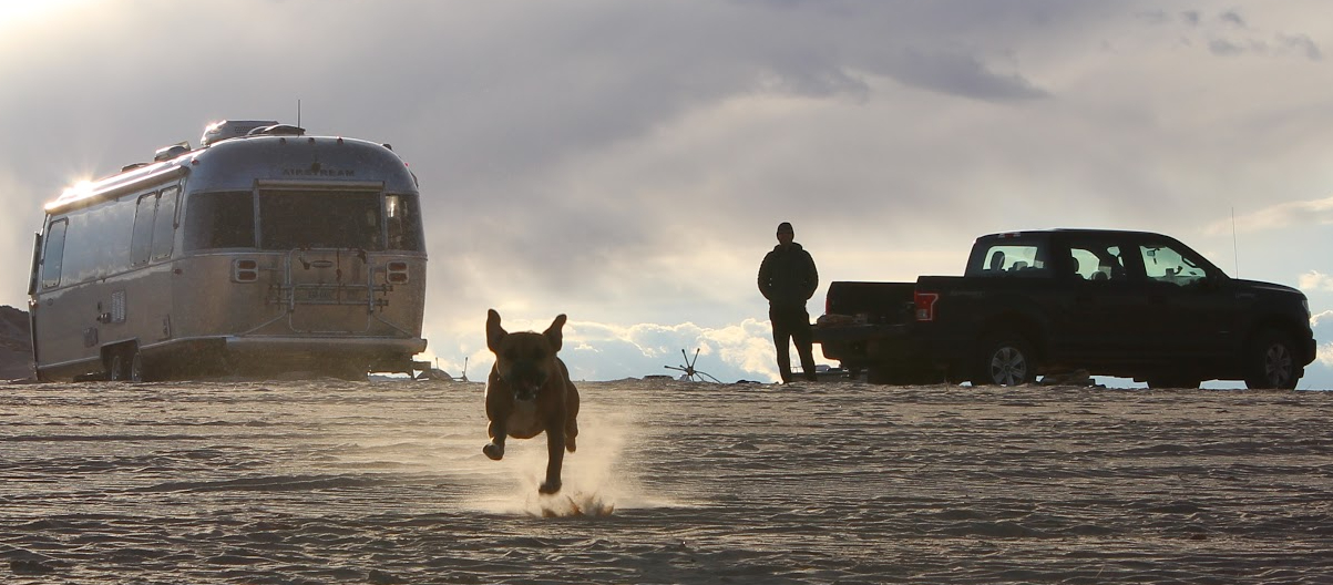
Anyway. We stayed at Diamond Lake RV Park, just north of the national park, only a few minutes longer drive to the lake as Mazama Campground. It’s a nice park–woodsy, not crowded in late September, and just up the hill from Diamond Lake, a fishing and cycling destination. We barely had cell service (Verizon) at the campground, and for a work meeting J had to drive down the hill to the boat ramp for a reliable connection, on the advice of the campground host.

While J was on his call in the truck, Bugsy and I walked a few miles on the 11-mile paved path around lake. It was a lovely stroll. We didn’t get views of the lake, but we passed through pretty woods, alongside a peaceful meadow fronting a volcano, over a creek and to a small lake. I’d love to ride a bike around the entire loop.

The RV park is part of Diamond Lake Resort, and old-school, rustic family resort with a lodge, cabins, a cafe, and boat rentals. Just north of the resort is a gas station that Google didn’t tell us about (I see it there now though) and we went on a slightly-panicked out-of-the-way drive all the way down to Mazama to fill up the truck. Thanks, Google!
Inside the national park

Crater Lake is ringed by Rim Drive, an incredibly scenic 33-mile road with loads of overlooks. The park visitor guide you receive at the entrance gate lists several can’t-miss stops along the way. We thought the best vistas along Rim Drive were on the west side of the park, where Wizard Island looks more dramatic. The scenic drive and the hikes are all very popular and can be crowded, so start early and be patient! Also be aware of animals crossing–a huge black bear crossed the road in front of us.
Hiking

Crater Lake National Park has 90 miles of hiking trails, but read the descriptions carefully, as not all the trails give you views of the lake. We felt like to maximize our Crater Lake experience, we should focus on hikes with lake views, but there are other interesting historical and environmental features of the park to check out.

Most of the hikes in the park are short and sweet. We mixed and matched from the visitor guide’s moderate and strenuous lists of hikes–but the longest hike with lake views is only 4.4 miles, so “strenuous” is relative. A couple of the (non-lake view) trails are dog-friendly, but we opted to take Bugsy hiking outside the national park instead.
Moderate: Discovery Point

Discovery Point is a two-mile total out-and-back along the crater rim between Rim Village and Discovery Point. It was the first hike we did in the park, and it was a wonderful introduction. It’s easy and flat and takes you through a peaceful forest with big views of the lake and Wizard Island.
Strenuous: Garfield Peak

Garfield Peak is a 3.6-mile out-and-back to the top of a peak with bonkers views of the lake and the Cascades beyond. I’d say if you’re only doing one hike in the national park, it should be this one.
Strenuous: Cleetwood Cove

Cleetwood Cove is the only hike that goes down to the water. It’s a very steep and switchbacky mile down to the ferry dock, where you can hang out on the rocks or even go for a swim (warmest average surface water temp is 60 degrees)! It was neat to touch the water and see it up close, but the hike would likely be pretty obnoxious on a crowded day when the ferry is running.
Strenuous: Mount Scott

Mount Scott is a longer hike, totaling about five miles, with views galore. It was a mostly-easy trip up, and it was cool to see the entire lake at a distance where we could fit the whole thing into a single photo. The longer length of this hike meant we shared the summit with fewer people, which was nice.
Other hikes we considered
Plaikni Falls, a two-mile waterfall hike, and Watchman Peak, 1.6 miles that we opted to skip since we’d get similar views from other less-crowded hikes.
Eating and drinking

We’re suckers for the neat old national park lodges, so had to stop for a drink at Crater Lake Lodge, built in 1915 at the edge of the lake. We had a cocktail made with Crater Lake Spirits (based in Bend, and inspired by–not made with–Crater Lake’s water) and an Oregon beer from a Eugene brewery while gazing at the water and using the lodge’s wi-fi. Wi-fi was a treat when we barely had cell service in the area.
I already mentioned our search for gas, which we found in Mazama Village. I was also able to get a stamp for my National Parks Passport book at the little visitor center there.
Outside the national park
In addition to gawking at the lake, we also needed to entertain Bugsy, and she loves a river hike. In addition to our walk on the super paved path along Diamond Lake, we hiked to two waterfalls in the Umpqua National Forest not far from the campground. If you can, pick up a Thundering Waters brochure from your campground or a visitor center for a fantastic guide to the local waterfalls and resident flora and fauna.
Hiking


We chose two waterfalls close to home: Toketee Falls and Watson Falls. They were both gorgeous, and quite different from each other. The hikes were short and pleasant and not very crowded, and if we’d stayed the extra day we would have gone back into the national forest for more waterfall hikes.
The bartender at Crater Lake Lodge also recommended Mill Creek Falls, another short hike to fabulous falls that’s not part of the Umpqua National Forest cluster.
Eating and drinking

As our campground is part of Diamond Lake Resort, we thought it would be fun to visit the lodge at the resort and let Bugsy play by the water. The resort has a restaurant and a lounge, and we first stopped at the lounge, but it was a weird, kind of creepy spot hidden in the bowels of the lodge. The restaurant was brighter and busier, and we were able to take drinks outside to a picnic table by the lake and watch Bugsy yell at ducks. The resort has a gift shop/convenience store/marina store that sells travel basics if you need something while you’re out in the middle of nowhere.

From Crater Lake we bid farewell to the Pacific Northwest, and headed south to our next national park, Lassen Volcanic, in northern California, stopping at another stunning waterfall along the way.


Leave a Reply