We were in Big Bend from February 1 to February 3, 2021, as part of our Winter Warmth Trip. Read about our past visits here: late 2018, early 2018, and 2016.

We love Big Bend! Is it our favorite National Park? Maybe! It’s too hard to choose, but Big Bend is in the running for sure. This is our fourth visit to Big Bend: the first time was just a day trip from Ft Davis in 2016, the second was a few days in early 2018, and we went back for a few more in late 2018.
Campground

Once again, we stayed in Cottonwood Campground. No hookups, no generators, just peace and beauty. We love it there, but next visit we plan to split our time between Cottonwood and Rio Grande Village (not the soulless RV campground–we tried a night there on our first trip and hated it). We’d love to be based in Chisos Basin, but we’re over the size limit for the access road.
Due to the pandemic, all Big Bend campgrounds are currently reservation-only. Wonder if they’ll go back to walkup-only at some point? Check the park website when you start planning your trip! We talked to several frustrated groups cruising through Cottonwood hoping for a campsite, not realizing everything had been booked way in advance.
Hiking
Balanced Rock


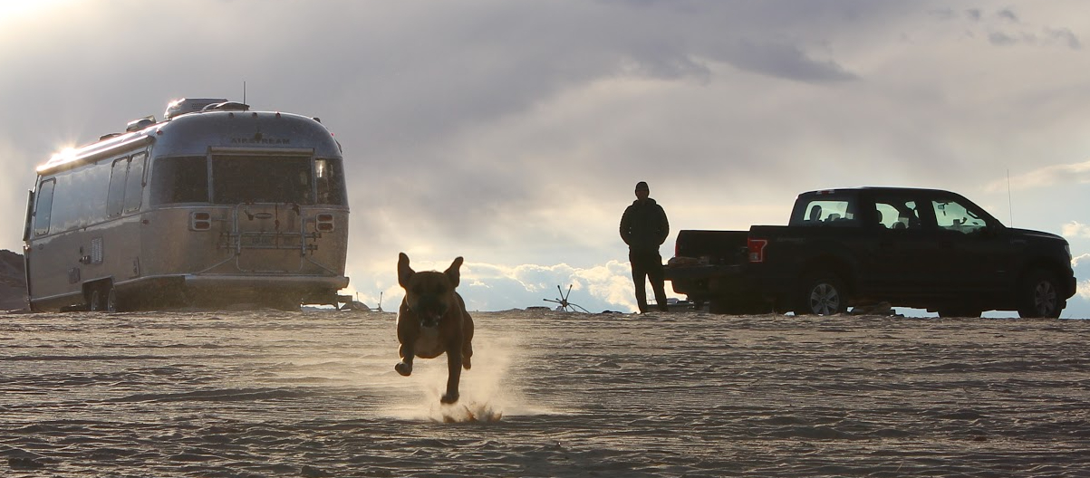
This is a short and sweet hike not too far from Panther Junction, the main visitor center and the first one you’ll reach when driving down from Marathon. Upon arriving in the park, we dropped the Airstream (and Bugsy) at the visitor center and popped up to this nice little trail, several miles down bumpy (a regular car could manage it) Grapevine Hills Road. It’s an easy 2.2-mile total out-and-back through a lovely wash to a fun jumble of boulders.
Lower Burro Mesa Pouroff

Another shorty, not too far from Cottonwood campground, Lower Burro Mesa Pouroff Trail takes you a half mile into the desert to the foot of a cliff. Look up 100 feet and you’ll see where Upper Burro Mesa Pouroff exits the rock wall. We liked it, but it’s probably more meaningful if you’ve hiked the Upper Burro Mesa Pouroff trail too (which we recommend, it’s a fantastic hike!)
Lost Mine + Casa Grande Summit

Another reason to check the park site before your visit: road closures could throw a wrench in your hiking schedule. Chisos Basin Road was closed for a few hours each morning and afternoon for construction, so we had to plan carefully to get in before the road closed for morning work, hike, and get out before the road closed again for afternoon work.

At the top of our to-do list for this visit was Lost Mine, and we had read that we should add on a summit of Casa Grande. Lost Mine by itself is just under five miles total, winding up and up through the forest to wide open views across the mountains. It is wonderful and we loved it and somehow (I suppose thanks to the road closure windows and our side excursion to Casa Grande) had it all to ourselves on the way up. Highly recommended. It’s normally very crowded, so go early!

If you tack on Casa Grande, you’ll total ten or eleven miles. Is it worth it? Maybe cooler (younger?) people would say yes. We say holy hell no don’t do it. We scrambled straight up on loose rock seemingly forever, got gorgeous 360° views at the top (the best of which you can get from Lost Mine, but not the full 360°), and then had to slide down the same loose rock. It was ROUGH. The trail was hard to follow, and maybe we weren’t even on the right trail… I don’t know. It was an adventure and we laughed about it later, but during… not so much.
Lost Mine, though–do it! But go early!
Mule Ears Spring to Smoky Creek Trail


On our last morning in the park, we wanted a longish hike close to home, and chose a seven-mile hike past Mule Ears Spring to Smoky Creek Trail. We’d hiked to Mule Ears Spring before; it’s a pretty (and pretty flat) trek through the desert with plenty of views of the mule ear-shaped rocks, one of our favorite landmarks in the park. Past the spring (barely a trickle) there’s a big descent to Smoky Creek Trail; not sure it’s worth going down to the trail junction just to turn around and climb back up. The vista from the top of the climb is beautiful, though!
To do
Ernst Tinaja trail: this short trail featuring a slot canyon is a big reason we want to spend a night or two in Rio Grande Village next trip
While staying on the east side of the park, take a scenic drive down Old Ore Rd and River Road East. Our scenic drives generally include Bugsy and a cooler.
South Rim + East Rim loop: our favorite hike in Big Bend is to the South Rim, but it’s a long one. We are desperate to go back and do the even longer loop that includes the entire South Rim trail and the East Rim, but it’s like 15 miles, and we have a dog who can’t be alone in the Airstream for an entire day, so the plan is to make it a trail run.
Spend some time hiking in Big Bend Ranch State Park. The state park has been on our list for a while, but like our Austin vs San Antonio dilemma, we haven’t wanted to sacrifice time in the national park to visit. Why not hit them both?
And write a Favorites post combining all the adventures we’ve had across our four visits!


Leave a Reply